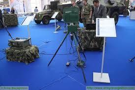
georadar system 12 -metal detectors for gold
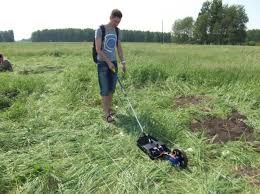
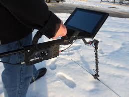
georadar 12 system, next-generation portable and high technology, the radar station is directly interfaced to notebook pentium with color display, to see what is in the subsoil and its stratigraphy. The georadar system 12 is essential for accurate surveys and surface and subsurface visions continue and non-destructive. Research excavations are not required, there is no risk of breaking lines or pipes and cables are not required to apply; only an antenna to pass on the ground.
The Georadar is indispensable for many applications: localising and optimisation of archaeological excavations, detection of buried objects and deposits, mines and tunnels, road Pavings, profiles of the subsoil, water, cracks and cavities, glaciology, pipes and cables detection and subsurface contaminated areas. Also used in civil engineering for landslide research and monitoring of bridges, buildings and structures in reinforced concrete, prefondazioni excavation, ect.
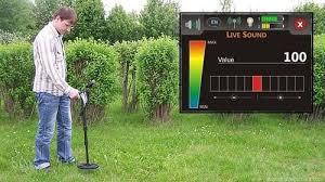
Technical data: data that are displayed in real time on your PC, display time range from 50 to 2000 nanosec, transmit range: 115 KHz, adjustable gain, filters: verticall/horizontal low and high-pass filter, matched filter, inverse filter, envelope filter migration, median filter, ect … data transfer via rs-232 c, 12V Dc, power consumption 0.7 Amps. high precision weight and early resolution. up to 30 Mt. the underworld with the help of the following antennas.
2000 Mhz unit dimensions 27x13x13 cm and 1.5 Kg weight maximum precision up to 2 m, 900 MHz unit dimensions 43x22x2, weight 2 kg, for depths up to five M. 500 MHz unit dim. 69x32x3 and weight four kg for prospecting to 10 m, 300 MHz unit dim. 98x52x4, weight ten kg for prospecting for up to 15 m, dipole in units from 150 MHz to six kg weight for prospecting for up to 30 M. The standard radar equipment consists of: operational radar station, notebooks with the special software and management operating manual in English, 2000 MHz interchangeable probe, battery and connection cables.
Three prospecting sample tubes buried underground at a depth of about 1.2 m. Each tube generates a signal with the Hyperbola, which Appendix is the location of the pipe. The detection was performed with sensitivity antenna from 2000 MHz. And prospecting of glaciers. Radar equipment attachments are added photo examples and exploration surveys accompanied with explanations. Radar equipment and related software are always under development.