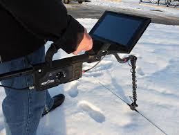
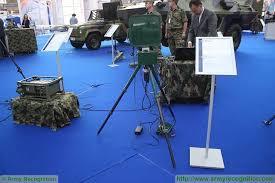
Geophysical verification system
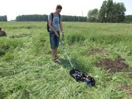
This system of exploration on the property and are measuring levels of electrical resistance to Earth, several sources of electricity, and also depends on the voltage measurement systems, electrodes in the soil and through wires to the console to measure and examine the entire area and ascertain the presence of metals or blanks or groundwater, and through the identification of the least electrical resistance values the system could distinguish between articles, depending on the interaction of land and depending on the electrical resistivity of each article.
How to detect this system objectives:.
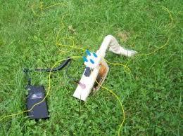
The system relies on detecting and finds and underground materials by the geophysical definition strictly electrical resistance of each metal in each article, this system is usually equipped with four exits of the electric power or can be 12 or 24 outlet outlet connecting the wires to the soil sensors dry ground material stainless steel or copper material conductive energy and good distribution in the search area is a square or rectangle , Or if the multipolar placed beside her some other to cover the longitudinal. And the process of measurement between poles of power in order to read the article or the metal in the region wedged between them (magnates).
Applications:
• Search for groundwater
• Resources prospecting
• Geophysical system to explore ancient cities
• Inspection of rail
• Scanning and detection of metals minerals and metal resources
• Geological engineering surveys
• Identification of gaps and caves and tunnels
Some specs of devices that operate on this system:.
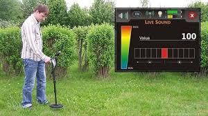
-Automatic or manual detection systems
-Clarify the results via a screen graphic illustrating results
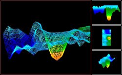
-Clarify the results via a laptop installed software 3D illustration to give a layered pictorial map of Earth.
-Great working hours operates
-Good haul which relaxes used in detecting
-Measure the depth level objectives found
-What type of underground waters and depths
-Inventory of drilling locations and posted.