location of underground utilities - traditionally the task facing utilities . During the years of operation of pipelines , cables gained experience , developed their own methods and processing methods pipelines diagnostics.
location of underground utilities – traditionally the task facing utilities . During the years of operation of pipelines , cables gained experience , developed their own methods and processing methods pipelines diagnostics , search for places and depressurization of pipelines damaged cable lines.
Today , due to many years of intensive development of areas in which interest is due to the presence of certain minerals, the task of the city limits migrated to ” open field .” This is typical for oil and gas regions . Here, for the years of development and exploitation of , once virgin territory in its bosom hide intricate , multi-storey network of different industrial communications , both existing and long-abandoned . This difficult task localization location , mapping and documenting this underground labyrinth laminated product lines fell on the shoulders geological software. This article we will try a little easier solution for this problem at least in the framework of orientation in a wide range of hardware offered tools and technologies so-called searching equipment .
– Magnetic ;
– Radio wave ;
– Electromagnetic .
Typically , the choice of appropriate equipment type determined problem to be solved . To determine the specific type and brand of equipment even need to consider the conditions of its application. When working in urban areas or in large industrial sites with high concentration of underground utilities play a crucial role immunity and spatial selectivity of the selected equipment. In practice, there are often complex cases that lead to ambiguous interpretation of the results . To reduce the probability of false positioning of underground utilities use a combination of hardware that implements a variety of physical methods . It is not always economically feasible . Therefore, manufacturers of this type of equipment often go the way of increasing consumer properties due to the implementation in one device several different methods .
1. Scanning radar ( GPR ) .
2 . Infrared thermography .
3 . Acoustic location .
4 . Electromagnetic location .
More detail on the method of electromagnetic location. This is a universal method of location and tracing of underground utilities . The advantage of this method is the ability to obtain ” from the ground ” for a large amount of information that is not available in any other technology . This method has the following characteristics:
1. Search from the ground surface and determining the presence of underground utilities ;
2 . Tracing and identification of certain lines;
3 . Measures the depth of communication directly from the ground ;
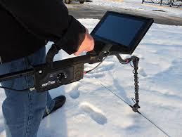
4 . Portability of equipment;
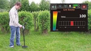
5 . Light weight equipment and the ability to leverage even inexperienced operator ( when the majority of the transactions);
6. The ability to use the equipment in all types of soil , even under water ;
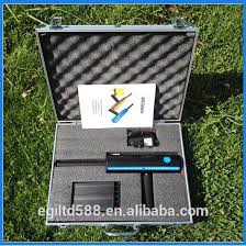
7. Partly cost of equipment and its components for implementing this method.
In the method is based on electromagnetic induction . Locators not determine the position of pipes and cables and detect a magnetic field around communication, created the alternating current flowing through it. The presence of the magnetic field around a current communication and allows you to define its position. While possible insulation from electric current , it is impossible to isolate the magnetic field. Isolation of communication or the presence of any type of soil does not change the form of the field . Alternating current creates a magnetic field detectable or “signal” . It not only causes the appearance of the field, but also causes it to reverse to an oscillating frequency changes , which enables efficient location using electromagnetic induction .
To begin with, that all currently known locators , both domestic and foreign , operating on the same principle – electromagnetic induction. All are responsive to an electric current flowing through the communication. There are current – work in passive mode ( without generator ) , there is no current – create it using a generator . Thus, we can conclude that any Locators can work and achieve equality of results. However, in practice it goes much harder , and the smallest features of the device allow much win in the end result . The most effective devices that can handle both the active mode and passive , which determines the presence of the receiver 2-3 active frequencies and industrial frequencies 50 and 100 Hz. Currently, these devices have the capability FM Series 9800 manufactured by Seba dinatronic ( Germany ), RD400 Radiodetection ( United Kingdom ), PL- 960 (920 ) FUJI TECOM inc., ( Japan) and foreign production series “Success ATG ” Company “Techno – AC ” (Kolomna ) series KP firm ANGSTREM – SP (Yaroslavl) , a series of” Contour ” company ” AKA -GEO “(Moscow ) ,” Finding 210D “” Svyazpribor ” series” TDI “” Oersted “, etc.
Locators , tend to have a highly selective heterodyne receiver , which provides high noise immunity and sensitivity makes it possible to work in a strong external interference in low signal level ( detection depth of communication – to 6metrov ) and increases the chances of success in communications saturated areas. Generally , the last problem now is very important , because in the ground sometimes happen something unimaginable : decades of communication fit into the earth, and no scheme , and now, when the need arises , it is very difficult to dig , without hurting anyone’s ” interests.” Untangling these tangles – great art. The preferred way to do this “by ear ” , based on the tone of the signal receiver. A true professional can reliably distinguish from the gas pipeline network , and not distinguish between the power cable from the pipeline poses no problems . It is this ” hearing ” benefits when in tone sound can pass on “their” line , while excluding “other” , we are deprived of using locators with microprocessor signal processing.
In addition, at your disposal 2-3 working frequency generator for the “active” and the ability to trace through inductive coupling via a transmitting antenna with a direct connection to the impossibility of communication. Import apparatus used for these purposes high frequency of 10 kHz and above. The main disadvantage of the electromagnetic location is that with it can not be done tracing plastic pipes .
To solve this complex problem only applies acoustic location method based on listening to the earth’s surface acoustic sensor signal produced by the generator of sound pulses in the pipeline. Thus, to solve all complex tasks of localization of underground utilities in the kit should include a generator of sound pulses . Currently, the only such domestic appliance is designed and produced by ” TECHNO- AC” (Kolomna ) . Foreign equivalent RSP- 3 (Seba dinatronic, Germany) . The presence of the acoustic sensor devices in the series ” The success of ATC “, ” The success of TFT » trace except the pipe materials , allows to solve problems surf spots depressurization of pipelines and locations cable line fault as induction and acoustic method . In addition , the presence of complete sensor voltage step ( DSHN ) allows you to search place downward insulation covers external communications, as well as finding fault location cable capacitance method .
Thus, to meet the challenges facing services , exploiting underground utilities :
– Localization and conducting trace underground utilities ;
– Control of external insulation covers communications;
– Search unapproved inserts in pipelines;
– Search places depressurization of pipelines;
– Fault location of power cable lines ;
– Control status ECP
most appropriate integrated appliances. The composition of such devices include a receiver ( with the presence of modes at frequencies of active and passive frequencies 50 Hz and 100 ” WB “), generator (2-3 active frequencies ) , a set of sensors ( acoustic, electromagnetic, capacitive ( DSHN ), etc. )


Post Tagged with : ground penetrating radar mobile | ground penetrating radar gold mining | lightweight ground penetrating radar | android table ground penetrating radar app | ground penetrating radar for rent | ground penetrating radar for gold reefs | ground penetrating radar for gold reefs | hand held ground penetrating radar | ground penetrating radar rental cost | android tablet ground penetrating radar program download | ground penetrating radar circuit diagram | ground penetrating radar circuit diagram | what is sir 3000 ground penetrating radar look like | portable ground penetrating radar system treasure hunting.