What is GEORADAR – GPR SIR- 3000
As the name of the device , ground penetrating radar has its main function of holding GPR research.
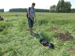
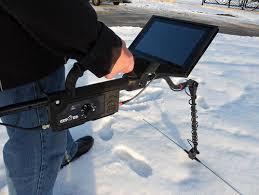
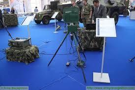
Ground penetrating radar - a mobile device that is used to produce a continuous section of the medium ( grading ) and the recording of the data in electronic form for further processing and analysis.
Ground penetrating radar uses the technology of cutting the soil, which does not need to conduct test excavations or control drilling , and the incision is obtained for the whole set depth , limited by technical capabilities used GPR . Therefore, GPR relate to methods of non-destructive investigation and monitoring.
Most of the work GPR get in industries such as construction, including GNB and other trenchless construction methods , geology , military science , archeology , etc.
What are the GPR ? In fact the name ” ground penetrating radar ” - simplified the name used for the convenience of the question. It is more correct to use the term ” subsurface sounding radar instrument .”
GPR consists of several functional units providing comprehensive task of forming and transferring pulses and interpreting the reflected / absorbed signals :
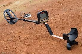
the antenna unit (consisting of several antennas for transmitting and receiving signals of different frequencies) ;
a control unit consisting of a series of opto- electrical converters and cable system ;
recording unit , in the form which is most commonly used laptop.
Operation GPR based on the differences in the reflection of an electromagnetic pulse emitted by the device (usually used frequency range from 400 MHz to 1500 MHz ) , or various objects of various types of soil . Depending on the time of the signal ( from its emission to reception of the reflected signal antenna GPR ) is determined and the depth at which there is a reflective object .
The sequence of the reflected signals are interpreted in the GPR profile, which is called ” section of the medium ” or ” radiogram ” . Based on the radiogram operator makes conclusions about the position of objects and boundaries of different soil layers in the thickness of the object .
The depth at which the GPR survey conducted depends on the frequency of the emitted pulse and the type of soil in which to get cut. The usual depth of GPR studies in soils , easy-to- scan radar (dry sand, frozen soil , limestone and rocks ) , up to 25 m loam ground penetrating radar is less effective .
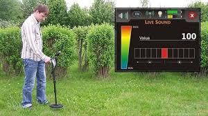
In studies GPR (more precisely , the antenna unit) is moved over the surface (or on its surface ) of the medium , wherein scanning takes place with a certain step which is advanced models GPR may be several millimeters.
For all its advantages , be aware that ground-penetrating radar - just a sophisticated precision instrument. Therefore, specifying parameters of GPR studies for each object , as well as analysis and interpretation radiogram should engage highly qualified specialist . Only in this case, the ground penetrating radar maximize your potential and help keep you in your business.